

A new park, more fire safety and not quite as many new residents: What’s in San Diego’s latest plan for the College Area
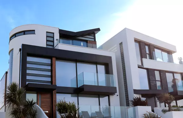
The latest version of San Diego’s sweeping blueprint for the College Area’s long-term future scales back ambitious growth plans in the face of some neighborhood opposition — but still envisions the population to grow by nearly threefold.
City planners’ second draft of the College Area Community Plan comes about six months after the city of San Diego published its first draft of the community plan update, which will guide land use, development and urban design policies for the next two to three decades.
Much like the first draft, the latest imagines the College Area with a lively campus town center, more and safer bike lanes and new green spaces along busy streets for residents to exercise and gather.
But planners also made some changes to the first draft in response to community concerns, including adding an opportunity for a pocket park on 54th Street and a policy to support coordination with San Diego State University for fire-safety needs.
Compared with the earlier draft, the new plan also sees lower density in some areas with higher fire risk, and higher density in the busier zone of El Cajon Boulevard near College Avenue and Montezuma Road.
“The overall development increase that is planned for didn’t change in the plan, but was redistributed in areas, largely focused on putting some of the increases in density along the corridors,” Heidi Vonblum, the city planning director, said in an interview.

The College Area plan has been updated four times since it was first adopted in 1965, and the neighborhood is currently operating under a plan update from 1989. The latest proposed update was released late last month, and community response has varied, much as it did when the first draft came out in January.
Robert Montana, who chairs the College Area Community Planning Group, objects to the plan’s calls for higher housing density. He says it’s unnecessary for the population growth officials expect, especially with new student housing being built on SDSU’s campus and with regional planners scaling back their population-growth expectations.
“It’s not city planning that they’re doing. It’s magical thinking,” he said. “It has nothing to do with reality.”
But the city has identified the College Area as a neighborhood that could take on significant growth in coming years to help accommodate San Diego’s future population, which is expected to grow by nearly 5% by 2050, from the current 1.37 million to 1.44 million, according to estimates from the San Diego Association of Governments.
In the second draft of the plan, the College Area could now see its population capacity reach about 74,000 people, living in around 34,000 homes. That’s down from the first draft, which envisioned more than 87,000 people.
The city says it calculated the figures for the first draft with outdated SANDAG data from May 2024, rather than updated figures from July 2024 that anticipate a smaller population increase in the neighborhood.
But even the reduced projection is still nearly three times the neighborhood’s current population — as of 2022, the College Area had more than 26,000 people and 8,000 homes, according to SANDAG.
The city has said that the College Area’s transit opportunities make it a good option for future population increases, but the College Area is also unlike many San Diego neighborhoods.
SDSU students share the area with families who have lived there for decades. The university is bordered by Interstate 8 and heavily trafficked Montezuma Road and College Avenue. And while it’s an urban area, canyons and open space are dispersed throughout.
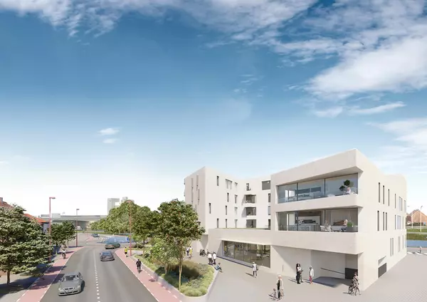
The latest draft of the community plan still includes a mix of zoning, including some higher-density mixed-use development near current and planned transit corridors, such as bus routes along Montezuma Avenue and trolley stations at 70th street and the SDSU Transit Center. Medium and lower-density housing would be concentrated on more residential streets farther from the SDSU campus.
But some areas designated as higher density in the first draft have been decreased to lower density, such as on East View Falls Drive and properties near the Campus Village Center south of Montezuma Road. Vonblum says this is due to potential fire risk, as those areas are also overlaid as fire hazard severity zones.

Some multi-family zoning in the Campus Village Center has also been altered in the second draft to community commercial zoning, which allows for the same maximum density but also lower-density housing and commercial uses — a change the city says will make for more flexibility.
“The vision for this part of the community remains the same: a campus village, well-connected to the rest of the community, with new public spaces, retail and commercial businesses, and homes,” Peter Kelly, the planning department spokesperson, said in an email. “The shift from a residential to a community commercial land use designation was made to better support that vision.”
Two sections at the neighborhood’s southwestern edge have also been removed and are being added to the Kensington-Talmadge community plan, at the request of both areas’ community planning groups. The zoning for those sections will remain the same, the city says.
But Saad Asad, spokesperson for YIMBY Democrats of San Diego County, which advocates for housing development, said shuffling changes to a separate plan update naturally restricts the potential for more housing. So do existing developments like Alvarado Estates, a 129-lot gated community with controlled-access streets and its own park.
That could make it harder for lower-income people, including students, to afford to live in the area, Asad said.
The city says the plan’s calls for growth along key corridors will allow for more housing for all income levels and reduce pressure on older, more affordable housing elsewhere.
Trudie Levin, who recently graduated from SDSU, still lives in the area but has had trouble finding affordable housing nearby. She said greater housing density will help address her concerns.
But she shared concerns expressed by Montana, the planning group chair, about a lack of sidewalks, particularly in areas like 63rd Street. She said people are expected to walk in the street for a significant portion.
“There’s a lot that needs to happen to make it more walkable,” she said.
The plan does envision pedestrian safety improvements, including raised sidewalks, rapid flashing-light beacons for crosswalks and raised median refuges for people crossing more than one lane of traffic. And the city said it would require new development to ensure continuous sidewalks on 63rd Street, since it’s been identified as a pedestrian connector street.

Asad said more density is even more important because SDSU’s recent Research 1 designation could exacerbate the housing shortage, as the school become a powerhouse and new students, researchers and faculty arrive.
“I feel like the bones of the plan are really good. I think there’s options for making some of the other neighborhoods less exclusionary, and some of them are just completely unchanged from how they have existed,” Asad said. “But I think the very mechanics of where we want housing — near transit, near your school, near your jobs — is exactly right.”
But other residents, including members of the community planning group and other neighborhood groups, still feel the plan doesn’t do enough to preserve the College Area’s areas of predominantly single-family homes.
To Julie Hamilton, who is president of the College Area Community Council and serves on the planning group’s plan update subcommittee, the new draft still doesn’t provide enough park space or safety infrastructure to serve the many more people it imagines in the area.
“There’s a balance between increased density and public improvements to support that density, and right now, the balance is entirely in the favor of increased density and without the infrastructure necessary,” she said.
The College Area is served by three fire stations in the surrounding neighborhoods, but residents want to see more of a focus on fire safety in future planning. And there is now one neighborhood park, the 1.6-acre Montezuma Park, which the city plans to improve with new features such as a shade pavilion and children’s play areas.
The public has until Sept. 7 to comment on the latest draft. The city expects to finalize the plan by this fall.
Categories
Recent Posts


GET MORE INFORMATION